 vesseltracker.com
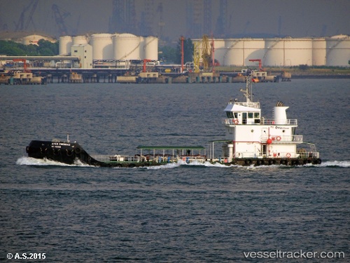
 Ayer Cherdas
Current Status
Where is the vessel?
Ayer Cherdas is currently in Near Singapore, based on AIS data received less than 1h ago.
Latest AIS update:
Current position: 1.22614° N, 103.81861° E (Near Singapore)
Average speed (last 7 days): Loading…
Average speed (last 30 days): Loading…
Vessel profile: Ayer Cherdas is a Water Tanker with dimensions 40m x 10m.
This page combines live AIS, route history, probable destination signals, nearby traffic, and port activity for practical vessel monitoring.
The current position of vessel Ayer Cherdas is 1.22614 lat / 103.81861 lng. Updated: 2026-05-16 07:52:18 UTCNearest reference points:
- Near Singapore
- Near Bukit Merah Estate
- Near BUKOM ISLAND
Currently sailing under the flag of Singapore ![]()
Details:
Live Vessel Ayer Cherdas Analytics (details, animations, etc.)
Recent AIS points (UTC):
2026-05-16 04:47:40 UTC · 1.22679, 103.81910 · SOG 0.1 kn · COG -1°2026-05-16 06:02:29 UTC · 1.22708, 103.81912 · SOG 0 kn · COG -1°
2026-05-16 07:47:38 UTC · 1.22622, 103.81863 · SOG 0 kn · COG -1°
2026-05-16 07:52:18 UTC · 1.22614, 103.81861 · SOG 0 kn · COG -1°