 vesseltracker.com
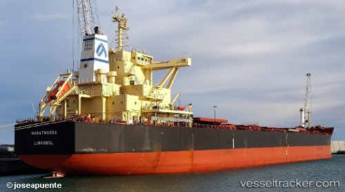
 MARATHASSA
Current Status
Where is the vessel?
MARATHASSA is currently in 55 nm W of LHOKNGA, based on AIS data received less than 1h ago.
Latest AIS update:
Current position: 5.62167° N, 94.33881° E (55 nm W of LHOKNGA)
Average speed (last 7 days): Loading…
Average speed (last 30 days): Loading…
Vessel profile: MARATHASSA is a Cargo with dimensions m x m.
This page combines live AIS, route history, probable destination signals, nearby traffic, and port activity for practical vessel monitoring.
The current position of vessel MARATHASSA is 5.62167 lat / 94.33881 lng. Updated: 2026-05-16 10:13:59 UTCNearest reference points:
- 80 nm W of Sebang
- 48 nm NW of Sebang
- 28 nm NW of Sebang
Details:
Live Vessel MARATHASSA Analytics (details, animations, etc.)
Recent AIS points (UTC):
2026-05-16 05:35:02 UTC · 5.16076, 93.58465 · SOG 11.9 kn · COG 53°2026-05-16 08:00:27 UTC · 5.39314, 93.97739 · SOG 11.5 kn · COG 52°
2026-05-16 08:03:50 UTC · 5.39940, 93.98588 · SOG 11 kn · COG 39°
2026-05-16 10:13:59 UTC · 5.62167, 94.33881 · SOG 11.7 kn · COG 55°