 vesseltracker.com
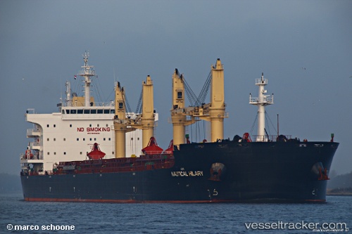
 STAR ANTWERP
Current Status
Where is the vessel?
STAR ANTWERP is currently in 18 nm E of Waterport, based on AIS data received less than 1h ago.
Latest AIS update:
Current position: 36.10494° N, 4.98511° W (18 nm E of Waterport)
Average speed (last 7 days): Loading…
Average speed (last 30 days): Loading…
Vessel profile: STAR ANTWERP is a Cargo with dimensions m x m.
This page combines live AIS, route history, probable destination signals, nearby traffic, and port activity for practical vessel monitoring.
The current position of vessel STAR ANTWERP is 36.10494 lat / -4.98511 lng. Updated: 2026-05-15 11:49:44 UTCNearest reference points:
- 30 nm E of Ceuta
- Near Waterport
- Near Sotogrande
Currently sailing under the flag of Liberia ![]()
Details:
Live Vessel STAR ANTWERP Analytics (details, animations, etc.)
Recent AIS points (UTC):
2026-05-15 08:13:25 UTC · 36.13616, -5.37504 · SOG 0.1 kn · COG 294°2026-05-15 09:25:40 UTC · 36.13720, -5.37444 · SOG 0.2 kn · COG 284°
2026-05-15 10:06:05 UTC · 36.13160, -5.38671 · SOG 6.7 kn · COG 182°
2026-05-15 11:49:44 UTC · 36.10494, -4.98511 · SOG 13.9 kn · COG 84°