 vesseltracker.com
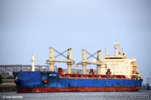
 ML HERON
Current Status
Where is the vessel?
ML HERON is currently in 70 nm E of Recife, based on AIS data received less than 1h ago.
Latest AIS update:
Current position: 8.21698° S, 33.69959° W (70 nm E of Recife)
Average speed (last 7 days): Loading…
Average speed (last 30 days): Loading…
Vessel profile: ML HERON is a Bulk Carrier with dimensions 200m x 32m.
This page combines live AIS, route history, probable destination signals, nearby traffic, and port activity for practical vessel monitoring.
The current position of vessel ML HERON is -8.21698 lat / -33.69959 lng. Updated: 2026-05-14 04:04:07 UTCNearest reference points:
- Near Boa Viagem
- Near Suape
Currently sailing under the flag of Liberia ![]()
ML HERON built in 2014 year
Deadweight:
63542 tDetails:
Live Vessel ML HERON Analytics (details, animations, etc.)
Recent AIS points (UTC):
2026-05-14 02:03:19 UTC · -7.94958, -33.42952 · SOG 11.3 kn · COG 223°2026-05-14 02:51:15 UTC · -8.05520, -33.53791 · SOG 11.4 kn · COG 223°
2026-05-14 03:33:06 UTC · -8.14756, -33.63152 · SOG 11.1 kn · COG 224°
2026-05-14 04:04:07 UTC · -8.21698, -33.69959 · SOG 11.3 kn · COG 223°