 vesseltracker.com
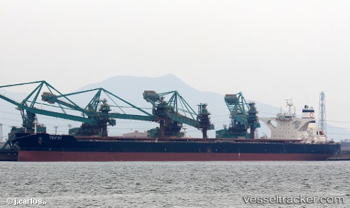
 Stellar Way
Current Status
Where is the vessel?
Stellar Way is currently in Near Gwangyang, based on AIS data received about 1h ago.
Latest AIS update:
Current position: 34.90407° N, 127.74948° E (Near Gwangyang)
Average speed (last 7 days): Loading…
Average speed (last 30 days): Loading…
Vessel profile: Stellar Way is a Ore Carrier with dimensions 330m x 57m.
This page combines live AIS, route history, probable destination signals, nearby traffic, and port activity for practical vessel monitoring.
The current position of vessel Stellar Way is 34.90407 lat / 127.74948 lng. Updated: 2026-05-15 19:51:50 UTCNearest reference points:
- Near Sangam-dong
- Near Gwangyang
- Near Boseong-gun
Currently sailing under the flag of Panama ![]()
Details:
Live Vessel Stellar Way Analytics (details, animations, etc.)
Recent AIS points (UTC):
2026-05-15 16:57:50 UTC · 34.90397, 127.74941 · SOG 0 kn · COG 282°2026-05-15 18:00:50 UTC · 34.90409, 127.74947 · SOG 0 kn · COG 282°
2026-05-15 19:36:50 UTC · 34.90403, 127.74946 · SOG 0 kn · COG 283°
2026-05-15 19:51:50 UTC · 34.90407, 127.74948 · SOG 0 kn · COG 283°