 vesseltracker.com
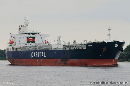
 Amor
Amor
Current Status
Where is the vessel?
Amor is currently in Near Freeport, based on AIS data received less than 1h ago.
Latest AIS update:
Current position: 26.52687° N, 78.80622° W (Near Freeport)
Average speed (last 7 days): Loading…
Average speed (last 30 days): Loading…
Vessel profile: Amor is a Chemical Oil Products Tanker with dimensions 183m x 32m.
This page combines live AIS, route history, probable destination signals, nearby traffic, and port activity for practical vessel monitoring.
The current position of vessel Amor is 26.52687 lat / -78.80622 lng. Updated: 2026-05-14 11:26:48 UTCNearest reference points:
- 44 nm S of Freeport
- 44 nm E of Surfside
- Near Palm Beach
Currently sailing under the flag of Liberia ![]()
Details:
Live Vessel Amor Analytics (details, animations, etc.)
Recent AIS points (UTC):
2026-05-14 07:59:53 UTC · 26.52711, -78.80625 · SOG 0.1 kn · COG 265°2026-05-14 10:22:44 UTC · 26.52709, -78.80625 · SOG 0.3 kn · COG 252°
2026-05-14 10:29:55 UTC · 26.52659, -78.80615 · SOG 0.2 kn · COG 279°
2026-05-14 11:26:48 UTC · 26.52687, -78.80622 · SOG 0.2 kn · COG 260°