 vesseltracker.com
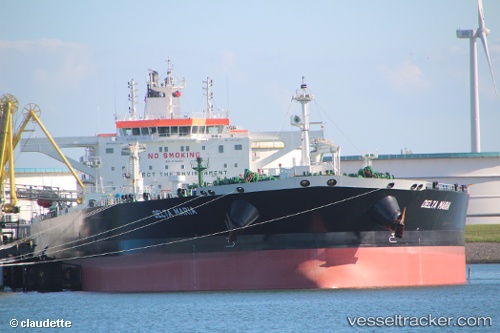
 DELTA MARIA
Current Status
Where is the vessel?
DELTA MARIA is currently in 34 nm NE of Qulaybiyah, based on AIS data received about 1h ago.
Latest AIS update:
Current position: 37.33154° N, 11.46659° E (34 nm NE of Qulaybiyah)
Average speed (last 7 days): Loading…
Average speed (last 30 days): Loading…
Vessel profile: DELTA MARIA is a Tanker with dimensions m x m.
This page combines live AIS, route history, probable destination signals, nearby traffic, and port activity for practical vessel monitoring.
The current position of vessel DELTA MARIA is 37.33154 lat / 11.46659 lng. Updated: 2026-04-29 01:37:33 UTCNearest reference points:
- 32 nm N of Qulaybiyah
- 13 nm N of Qulaybiyah
- Near MARSALA
Currently sailing under the flag of Malta ![]()
Details:
Live Vessel DELTA MARIA Analytics (details, animations, etc.)
Recent AIS points (UTC):
2026-04-28 23:06:51 UTC · 37.08024, 12.06793 · SOG 12.8 kn · COG 289°2026-04-28 23:25:43 UTC · 37.10170, 11.98901 · SOG 12.8 kn · COG 288°
2026-04-29 01:31:33 UTC · 37.32138, 11.49085 · SOG 13.1 kn · COG 297°
2026-04-29 01:37:33 UTC · 37.33154, 11.46659 · SOG 13.1 kn · COG 298°