 vesseltracker.com
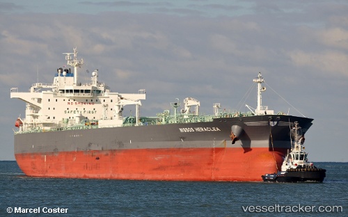
 TORM KIARA
Current Status
Where is the vessel?
TORM KIARA is currently in Near BRIELLE, based on AIS data received less than 1h ago.
Latest AIS update:
Current position: 51.92746° N, 4.20640° E (Near BRIELLE)
Average speed (last 7 days): Loading…
Average speed (last 30 days): Loading…
Vessel profile: TORM KIARA is a Crude Oil Tanker with dimensions 45m x 252m.
This page combines live AIS, route history, probable destination signals, nearby traffic, and port activity for practical vessel monitoring.
The current position of vessel TORM KIARA is 51.92746 lat / 4.20640 lng. Updated: 2026-05-16 15:31:25 UTCNearest reference points:
- Near Maassluis
- Near BRIELLE
- Near Zwartewaal
Currently sailing under the flag of Denmark (DIS) ![]()
TORM KIARA built in 2015 year
Deadweight:
114270 tDetails:
Live Vessel TORM KIARA Analytics (details, animations, etc.)
Recent AIS points (UTC):
2026-05-16 12:22:25 UTC · 51.92744, 4.20646 · SOG 0 kn · COG 310°2026-05-16 13:58:25 UTC · 51.92746, 4.20641 · SOG 0 kn · COG 310°
2026-05-16 14:07:24 UTC · 51.92748, 4.20637 · SOG 0 kn · COG 310°
2026-05-16 15:31:25 UTC · 51.92746, 4.20640 · SOG 0 kn · COG 310°