 vesseltracker.com
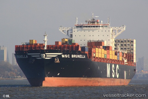
 MSC BRUNELLA
Current Status
Where is the vessel?
MSC BRUNELLA is currently in 24 nm S of Wilga, based on AIS data received less than 1h ago.
Latest AIS update:
Current position: 52.04365° N, 2.40265° E (24 nm S of Wilga)
Average speed (last 7 days): Loading…
Average speed (last 30 days): Loading…
Vessel profile: MSC BRUNELLA is a Container Ship with dimensions 48m x 301m.
This page combines live AIS, route history, probable destination signals, nearby traffic, and port activity for practical vessel monitoring.
The current position of vessel MSC BRUNELLA is 52.04365 lat / 2.40265 lng. Updated: 2026-05-14 10:14:05 UTCNearest reference points:
- 21 nm S of Craven Arms
- Near Craven Arms
- 11 nm NW of Krieschow
Currently sailing under the flag of Portugal (MAR) ![]()
MSC BRUNELLA built in 2015 year
Deadweight:
109832 tDetails:
Live Vessel MSC BRUNELLA Analytics (details, animations, etc.)
Recent AIS points (UTC):
2026-05-14 05:45:45 UTC · 52.01421, 2.40762 · SOG 9.9 kn · COG 345°2026-05-14 08:00:06 UTC · 51.98120, 2.38634 · SOG 1.9 kn · COG 118°
2026-05-14 08:25:24 UTC · 51.96836, 2.38138 · SOG 1.7 kn · COG 134°
2026-05-14 10:14:05 UTC · 52.04365, 2.40265 · SOG 7.3 kn · COG 7°