 vesseltracker.com
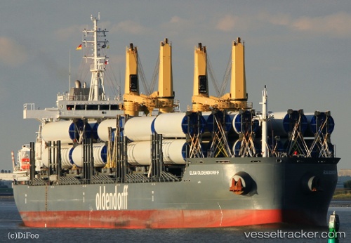
 ELSA OLDENDORFF
Current Status
Where is the vessel?
ELSA OLDENDORFF is currently in 225 nm SW of Gan, based on AIS data received about 1h ago.
Latest AIS update:
Current position: 3.11975° S, 70.28221° E (225 nm SW of Gan)
Average speed (last 7 days): Loading…
Average speed (last 30 days): Loading…
Vessel profile: ELSA OLDENDORFF is a General Cargo Ship with dimensions 30m x 180m.
This page combines live AIS, route history, probable destination signals, nearby traffic, and port activity for practical vessel monitoring.
The current position of vessel ELSA OLDENDORFF is -3.11975 lat / 70.28221 lng. Updated: 2026-05-15 04:51:20 UTCNearest reference points:
- 222 nm SW of Gan
Currently sailing under the flag of Portugal (MAR) ![]()
ELSA OLDENDORFF built in 2015 year
Deadweight:
38330 tDetails:
Live Vessel ELSA OLDENDORFF Analytics (details, animations, etc.)
Recent AIS points (UTC):
2026-05-15 01:04:12 UTC · -2.88342, 70.85207 · SOG 10 kn · COG 243°2026-05-15 03:35:44 UTC · -3.05381, 70.47729 · SOG 9.6 kn · COG 240°
2026-05-15 04:38:23 UTC · -3.10912, 70.31640 · SOG 9.8 kn · COG 248°
2026-05-15 04:51:20 UTC · -3.11975, 70.28221 · SOG 9.9 kn · COG 248°