 vesseltracker.com
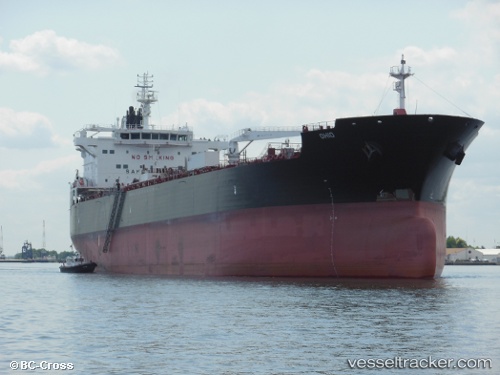
 Ohio
Ohio
Current Status
Where is the vessel?
Ohio is currently in Near Port Angeles, based on AIS data received about 2h ago.
Latest AIS update:
Current position: 48.13262° N, 123.43047° W (Near Port Angeles)
Average speed (last 7 days): Loading…
Average speed (last 30 days): Loading…
Vessel profile: Ohio is a Crude Oil Tanker with dimensions 183m x 183m.
This page combines live AIS, route history, probable destination signals, nearby traffic, and port activity for practical vessel monitoring.
The current position of vessel Ohio is 48.13262 lat / -123.43047 lng. Updated: 2026-04-30 01:49:33 UTCNearest reference points:
- Near Colwood
- Near Victoria
- Near ESQUIMALT
Currently sailing under the flag of USA ![]()
Details:
Live Vessel Ohio Analytics (details, animations, etc.)
Recent AIS points (UTC):
2026-04-29 22:34:29 UTC · 48.13471, -123.43353 · SOG 0 kn · COG 156°2026-04-30 00:08:29 UTC · 48.13167, -123.43333 · SOG 0 kn · COG -1°
2026-04-30 01:22:30 UTC · 48.13255, -123.43050 · SOG 0 kn · COG 292°
2026-04-30 01:49:33 UTC · 48.13262, -123.43047 · SOG 0 kn · COG 295°