 vesseltracker.com
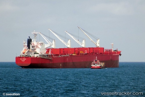
 NOBLE ISLAND
Current Status
Where is the vessel?
NOBLE ISLAND is currently in 13 nm E of Otoque Oriente, based on AIS data received about 1h ago.
Latest AIS update:
Current position: 8.61471° N, 79.37747° W (13 nm E of Otoque Oriente)
Average speed (last 7 days): Loading…
Average speed (last 30 days): Loading…
Vessel profile: NOBLE ISLAND is a Bulk Carrier with dimensions 32m x 199m.
This page combines live AIS, route history, probable destination signals, nearby traffic, and port activity for practical vessel monitoring.
The current position of vessel NOBLE ISLAND is 8.61471 lat / -79.37747 lng. Updated: 2026-05-14 02:28:41 UTCNearest reference points:
- Near Panama
- Near Melones
- Near Saboga
Currently sailing under the flag of Hong Kong, China ![]()
NOBLE ISLAND built in 2015 year
Deadweight:
61115 tDetails:
Live Vessel NOBLE ISLAND Analytics (details, animations, etc.)
Recent AIS points (UTC):
2026-05-13 23:03:16 UTC · 8.00066, -79.36765 · SOG 9.7 kn · COG 4°2026-05-14 00:19:37 UTC · 8.21833, -79.36333 · SOG 10 kn · COG -1°
2026-05-14 01:38:32 UTC · 8.46346, -79.36756 · SOG 11.2 kn · COG 358°
2026-05-14 02:28:41 UTC · 8.61471, -79.37747 · SOG 11 kn · COG 344°