 vesseltracker.com
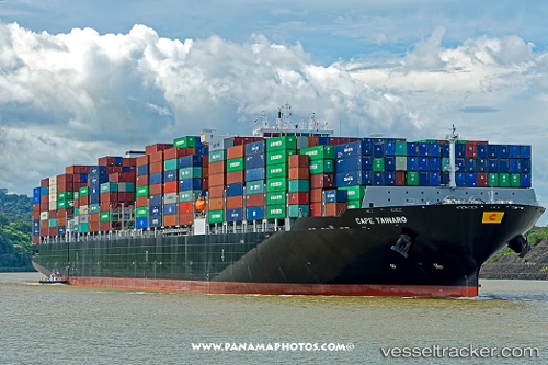
 Cape Tainaro
Current Status
Where is the vessel?
Cape Tainaro is currently in 203 nm SW of Kafr Kanna, based on AIS data received less than 1h ago.
Latest AIS update:
Current position: 31.35416° N, 38.98800° W (203 nm SW of Kafr Kanna)
Average speed (last 7 days): Loading…
Average speed (last 30 days): Loading…
Vessel profile: Cape Tainaro is a Container Ship with dimensions 330m x 48m.
This page combines live AIS, route history, probable destination signals, nearby traffic, and port activity for practical vessel monitoring.
The current position of vessel Cape Tainaro is 31.35416 lat / -38.98800 lng. Updated: 2026-05-13 19:54:40 UTCNearest reference points:
- 197 nm W of Kafr Kanna
Currently sailing under the flag of Malta ![]()
Details:
Live Vessel Cape Tainaro Analytics (details, animations, etc.)
Recent AIS points (UTC):
2026-05-13 16:34:53 UTC · 31.02144, -40.15228 · SOG 18.9 kn · COG 71°2026-05-13 18:11:19 UTC · 31.18022, -39.59121 · SOG 19 kn · COG 72°
2026-05-13 19:11:00 UTC · 31.28409, -39.24454 · SOG 19.1 kn · COG 72°
2026-05-13 19:54:40 UTC · 31.35416, -38.98800 · SOG 18.5 kn · COG 70°