 vesseltracker.com
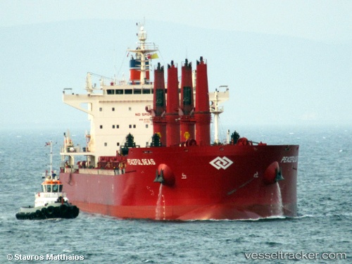
 Peaceful Seas
Current Status
Where is the vessel?
Peaceful Seas is currently in Near Hunsdon, based on AIS data received less than 1h ago.
Latest AIS update:
Current position: 51.80945° N, 3.32160° E (Near Hunsdon)
Average speed (last 7 days): Loading…
Average speed (last 30 days): Loading…
Vessel profile: Peaceful Seas is a Bulk Carrier with dimensions 199m x 32m.
This page combines live AIS, route history, probable destination signals, nearby traffic, and port activity for practical vessel monitoring.
The current position of vessel Peaceful Seas is 51.80945 lat / 3.32160 lng. Updated: 2026-05-15 13:07:28 UTCNearest reference points:
- Near Hunsdon
- 12 nm NE of Hunsdon
- Near Thorntonbank
Currently sailing under the flag of Liberia ![]()
Details:
Live Vessel Peaceful Seas Analytics (details, animations, etc.)
Recent AIS points (UTC):
2026-05-15 10:01:29 UTC · 51.80571, 3.31964 · SOG 0 kn · COG 335°2026-05-15 10:16:28 UTC · 51.80611, 3.32083 · SOG 0.4 kn · COG 322°
2026-05-15 11:43:27 UTC · 51.80880, 3.32200 · SOG 0.6 kn · COG 268°
2026-05-15 13:07:28 UTC · 51.80945, 3.32160 · SOG 0.9 kn · COG 254°