 vesseltracker.com
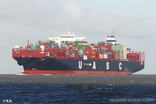
 Sajir
Sajir
Current Status
Where is the vessel?
Sajir is currently in 42 nm NE of Belawan, based on AIS data received less than 1h ago.
Latest AIS update:
Current position: 4.23470° N, 99.21498° E (42 nm NE of Belawan)
Average speed (last 7 days): Loading…
Average speed (last 30 days): Loading…
Vessel profile: Sajir is a Container Ship with dimensions 368m x 368m.
This page combines live AIS, route history, probable destination signals, nearby traffic, and port activity for practical vessel monitoring.
The current position of vessel Sajir is 4.23470 lat / 99.21498 lng. Updated: 2026-05-15 07:33:12 UTCNearest reference points:
- 43 nm NE of Perbaungan
- 10 nm NE of Belawan
- 43 nm NE of PANGKALAN SUSU
Currently sailing under the flag of Germany ![]()
Details:
Live Vessel Sajir Analytics (details, animations, etc.)
Recent AIS points (UTC):
2026-05-15 04:20:35 UTC · 4.74758, 98.61489 · SOG 15.2 kn · COG 126°2026-05-15 06:04:53 UTC · 4.47682, 98.93640 · SOG 15.3 kn · COG 140°
2026-05-15 07:29:31 UTC · 4.24308, 99.20164 · SOG 14.9 kn · COG 121°
2026-05-15 07:33:12 UTC · 4.23470, 99.21498 · SOG 14.9 kn · COG 120°