 vesseltracker.com
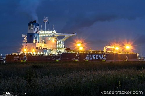
 VIETNAM PROSPERITY
Current Status
Where is the vessel?
VIETNAM PROSPERITY is currently in 113 nm S of La Restinga, based on AIS data received less than 1h ago.
Latest AIS update:
Current position: 25.74329° N, 17.71257° W (113 nm S of La Restinga)
Average speed (last 7 days): Loading…
Average speed (last 30 days): Loading…
Vessel profile: VIETNAM PROSPERITY is a Tanker with dimensions m x m.
This page combines live AIS, route history, probable destination signals, nearby traffic, and port activity for practical vessel monitoring.
The current position of vessel VIETNAM PROSPERITY is 25.74329 lat / -17.71257 lng. Updated: 2026-05-14 22:22:50 UTCNearest reference points:
- 110 nm NE of Las Brujas
- 68 nm NW of Ad Dakhla
- Near PUERTO DE LA ESTACA
Currently sailing under the flag of Liberia ![]()
Details:
Live Vessel VIETNAM PROSPERITY Analytics (details, animations, etc.)
Recent AIS points (UTC):
2026-05-14 18:07:53 UTC · 25.82765, -17.58463 · SOG 2.1 kn · COG 257°2026-05-14 19:11:00 UTC · 25.80456, -17.61451 · SOG 1.9 kn · COG 261°
2026-05-14 19:45:19 UTC · 25.79321, -17.63119 · SOG 2 kn · COG 278°
2026-05-14 22:22:50 UTC · 25.74329, -17.71257 · SOG 1.9 kn · COG 262°