 vesseltracker.com
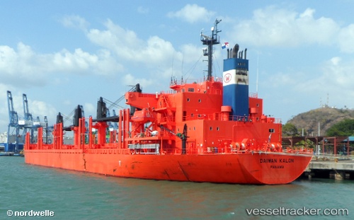
 Daiwan Kalon
Current Status
Where is the vessel?
Daiwan Kalon is currently in Near Algiers, based on AIS data received about 2h ago.
Latest AIS update:
Current position: 36.79760° N, 3.08408° E (Near Algiers)
Average speed (last 7 days): Loading…
Average speed (last 30 days): Loading…
Vessel profile: Daiwan Kalon is a Bulk Carrier with dimensions 180m x 30m.
This page combines live AIS, route history, probable destination signals, nearby traffic, and port activity for practical vessel monitoring.
The current position of vessel Daiwan Kalon is 36.79760 lat / 3.08408 lng. Updated: 2026-05-14 01:24:38 UTCNearest reference points:
- Near Algiers
- 16 nm NE of Berja
- 17 nm S of Albanchez
Currently sailing under the flag of Panama ![]()
Details:
Live Vessel Daiwan Kalon Analytics (details, animations, etc.)
Recent AIS points (UTC):
2026-05-13 22:57:37 UTC · 36.79726, 3.08435 · SOG 0.2 kn · COG 209°2026-05-13 23:51:37 UTC · 36.79728, 3.08315 · SOG 0 kn · COG 166°
2026-05-14 01:21:36 UTC · 36.79762, 3.08404 · SOG 0.1 kn · COG 194°
2026-05-14 01:24:38 UTC · 36.79760, 3.08408 · SOG 0 kn · COG 195°