 vesseltracker.com
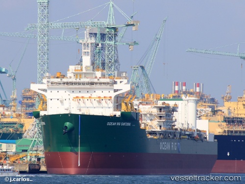
 SANTORINI
Current Status
Where is the vessel?
SANTORINI is currently in 54 nm NW of Haifa Granaries, based on AIS data received less than 1h ago.
Latest AIS update:
Current position: 33.17528° N, 34.00068° E (54 nm NW of Haifa Granaries)
Average speed (last 7 days): Loading…
Average speed (last 30 days): Loading…
Vessel profile: SANTORINI is a Drilling Ship with dimensions 42m x 228m.
This page combines live AIS, route history, probable destination signals, nearby traffic, and port activity for practical vessel monitoring.
The current position of vessel SANTORINI is 33.17528 lat / 34.00068 lng. Updated: 2026-05-14 21:35:52 UTCNearest reference points:
- 22 nm W of Haifa Granaries
- Near Haifa
- 31 nm SE of Vasilikos
Currently sailing under the flag of Bahamas ![]()
SANTORINI built in 2021 year
Deadweight:
59352 tDetails:
Live Vessel SANTORINI Analytics (details, animations, etc.)
Recent AIS points (UTC):
2026-05-14 18:23:17 UTC · 33.17531, 34.00069 · SOG 0 kn · COG 285°2026-05-14 19:41:26 UTC · 33.17530, 34.00068 · SOG 0 kn · COG 285°
2026-05-14 19:48:56 UTC · 33.17525, 34.00071 · SOG 0 kn · COG 285°
2026-05-14 21:35:52 UTC · 33.17528, 34.00068 · SOG 0.1 kn · COG 285°