 vesseltracker.com
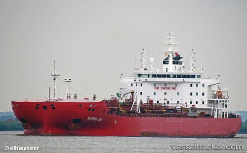
Hafnia Ane
Current StatusWhere is the vessel?
Hafnia Ane is currently in 118 nm SE of Porto Santo Island, based on AIS data received about 1h ago.
Latest AIS update:
Current position: 31.70364° N, 14.65500° W (118 nm SE of Porto Santo Island)
Average speed (last 7 days): Loading…
Average speed (last 30 days): Loading…
Vessel profile: Hafnia Ane is a Chemical Oil Products Tanker with dimensions 32m x 183m.
This page combines live AIS, route history, probable destination signals, nearby traffic, and port activity for practical vessel monitoring.
The current position of vessel Hafnia Ane is 31.70364 lat / -14.65500 lng. Updated: 2026-05-02 17:01:41 UTCNearest reference points:
- 148 nm SE of Porto Santo Island
- 120 nm N of Bañaderos
- 109 nm E of Porto Santo Island
Details:
Live Vessel Hafnia Ane Analytics (details, animations, etc.)
Recent AIS points (UTC):
2026-05-02 14:05:04 UTC · 31.14314, -14.82761 · SOG 11.9 kn · COG 15°2026-05-02 16:16:19 UTC · 31.55972, -14.69682 · SOG 11.9 kn · COG 11°
2026-05-02 16:51:30 UTC · 31.67168, -14.66521 · SOG 11.8 kn · COG 12°
2026-05-02 17:01:41 UTC · 31.70364, -14.65500 · SOG 11.5 kn · COG 13°