 vesseltracker.com
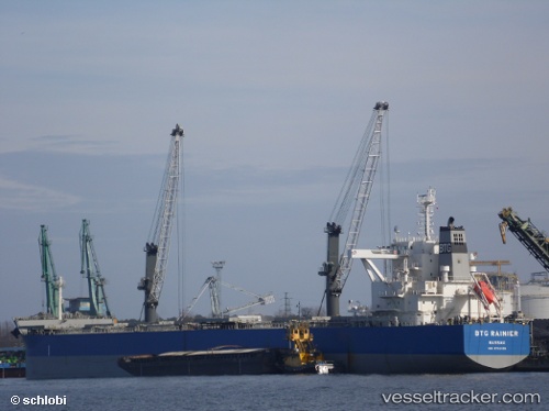
 Btg Rainier
Current Status
Where is the vessel?
Btg Rainier is currently in Near Cape St. Jacques, based on AIS data received about 1h ago.
Latest AIS update:
Current position: 10.25994° N, 107.03026° E (Near Cape St. Jacques)
Average speed (last 7 days): Loading…
Average speed (last 30 days): Loading…
Vessel profile: Btg Rainier is a Bulk Carrier with dimensions 229m x 229m.
This page combines live AIS, route history, probable destination signals, nearby traffic, and port activity for practical vessel monitoring.
The current position of vessel Btg Rainier is 10.25994 lat / 107.03026 lng. Updated: 2026-05-15 06:17:05 UTCNearest reference points:
- Near Cape St. Jacques
- Near Cape Saint Jacques
- Near Cai Mep
Currently sailing under the flag of Bahamas ![]()
Details:
Live Vessel Btg Rainier Analytics (details, animations, etc.)
Recent AIS points (UTC):
2026-05-14 23:40:35 UTC · 10.25658, 107.03090 · SOG 0 kn · COG 308°2026-05-15 04:22:12 UTC · 10.25889, 107.02760 · SOG 0 kn · COG 114°
2026-05-15 04:32:26 UTC · 10.25902, 107.02765 · SOG 0 kn · COG 118°
2026-05-15 06:17:05 UTC · 10.25994, 107.03026 · SOG 0.2 kn · COG 197°