 vesseltracker.com
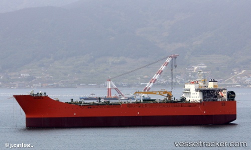
 Mariner B
Current Status
Where is the vessel?
Mariner B is currently in 15 nm W of Beryl Platform, based on AIS data received about 1h ago.
Latest AIS update:
Current position: 59.60667° N, 1.07667° E (15 nm W of Beryl Platform)
Average speed (last 7 days): Loading…
Average speed (last 30 days): Loading…
Vessel profile: Mariner B is a Fso Oil with dimensions 250m x 250m.
This page combines live AIS, route history, probable destination signals, nearby traffic, and port activity for practical vessel monitoring.
The current position of vessel Mariner B is 59.60667 lat / 1.07667 lng. Updated: 2026-05-14 20:01:06 UTCNearest reference points:
- 10 nm N of Leadon
- Near Alba Oil Field
Currently sailing under the flag of United Kingdom ![]()
Details:
Live Vessel Mariner B Analytics (details, animations, etc.)
Recent AIS points (UTC):
2026-05-14 16:15:17 UTC · 59.60694, 1.07659 · SOG 0.2 kn · COG -1°2026-05-14 17:21:18 UTC · 59.60698, 1.07662 · SOG 0.4 kn · COG -1°
2026-05-14 19:43:08 UTC · 59.60667, 1.07500 · SOG 0 kn · COG -1°
2026-05-14 20:01:06 UTC · 59.60667, 1.07667 · SOG 0 kn · COG -1°