 vesseltracker.com
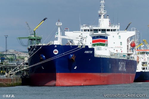
Anikitos
Current StatusWhere is the vessel?
Anikitos is currently in 27 nm E of Slipi, based on AIS data received about 2h ago.
Latest AIS update:
Current position: 6.22271° N, 107.23217° E (27 nm E of Slipi)
Average speed (last 7 days): Loading…
Average speed (last 30 days): Loading…
Vessel profile: Anikitos is a Chemical Oil Products Tanker with dimensions 32m x 183m.
This page combines live AIS, route history, probable destination signals, nearby traffic, and port activity for practical vessel monitoring.
The current position of vessel Anikitos is 6.22271 lat / 107.23217 lng. Updated: 2026-05-13 03:09:25 UTCNearest reference points:
- 36 nm SW of Slipi
- 11 nm N of Gombong
- 46 nm E of Kakap Natuna Terminal
Details:
Live Vessel Anikitos Analytics (details, animations, etc.)
Recent AIS points (UTC):
2026-05-13 00:48:05 UTC · 6.61203, 107.48407 · SOG 12.3 kn · COG 216°2026-05-13 03:09:25 UTC · 6.22271, 107.23217 · SOG 12.5 kn · COG 205°
2026-05-13 03:09:25 UTC · 6.22271, 107.23217 · SOG 12.5 kn · COG 205°
2026-05-13 03:09:25 UTC · 6.22271, 107.23217 · SOG 12.5 kn · COG 205°