 vesseltracker.com
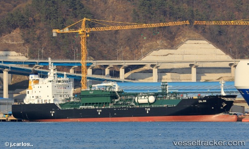
Dilos
Current StatusWhere is the vessel?
Dilos is currently in Near Air Parcel Sorting Office/Mumbai, based on AIS data received about 1h ago.
Latest AIS update:
Current position: 18.86241° N, 72.84813° E (Near Air Parcel Sorting Office/Mumbai)
Average speed (last 7 days): Loading…
Average speed (last 30 days): Loading…
Vessel profile: Dilos is a Lpg Tanker with dimensions 23m x 147m.
This page combines live AIS, route history, probable destination signals, nearby traffic, and port activity for practical vessel monitoring.
The current position of vessel Dilos is 18.86241 lat / 72.84813 lng. Updated: 2026-04-19 06:09:53 UTCNearest reference points:
- Near Mumbai
- Near HNB SEZ/Mumbai
- Near NHAVA SHEVA
Details:
Live Vessel Dilos Analytics (details, animations, etc.)
Recent AIS points (UTC):
2026-04-18 23:36:53 UTC · 18.86009, 72.84592 · SOG 0 kn · COG 40°2026-04-19 02:21:57 UTC · 18.86134, 72.84785 · SOG 0 kn · COG 271°
2026-04-19 04:13:10 UTC · 18.86265, 72.84775 · SOG 0 kn · COG -1°
2026-04-19 06:09:53 UTC · 18.86241, 72.84813 · SOG 0 kn · COG 244°