 vesseltracker.com
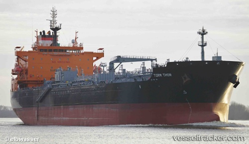
 TORM THOR
Current Status
Where is the vessel?
TORM THOR is currently in 287 nm NE of Alexandra Land, based on AIS data received about 635d ago.
Latest AIS update:
Current position: 84.43403° N, 72.36960° E (287 nm NE of Alexandra Land)
Average speed (last 7 days): Loading…
Average speed (last 30 days): Loading…
Vessel profile: TORM THOR is a Chemical/Oil Products Tanker with dimensions 32m x 183m.
This page combines live AIS, route history, probable destination signals, nearby traffic, and port activity for practical vessel monitoring.
The current position of vessel TORM THOR is 84.43403 lat / 72.36960 lng. Updated: 2024-08-16 16:44:20 UTCCurrently sailing under the flag of Denmark (DIS) ![]()
TORM THOR built in 2015 year
Deadweight:
49667 tDetails:
Live Vessel TORM THOR Analytics (details, animations, etc.)
Recent AIS points (UTC):
2024-08-16 16:44:20 UTC · 84.43403, 72.36960 · SOG 30.9 kn · COG -1°