 vesseltracker.com
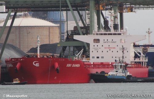
 S SAMBA
Current Status
Where is the vessel?
S SAMBA is currently in Near Newport News, based on AIS data received less than 1h ago.
Latest AIS update:
Current position: 36.96710° N, 76.42945° W (Near Newport News)
Average speed (last 7 days): Loading…
Average speed (last 30 days): Loading…
Vessel profile: S SAMBA is a Cargo with dimensions m x m.
This page combines live AIS, route history, probable destination signals, nearby traffic, and port activity for practical vessel monitoring.
The current position of vessel S SAMBA is 36.96710 lat / -76.42945 lng. Updated: 2026-04-28 09:25:32 UTCNearest reference points:
- Near Newport News
- Near Hampton Roads Pt
- Near Sewell's Point
Currently sailing under the flag of Portugal ![]()
Details:
Live Vessel S SAMBA Analytics (details, animations, etc.)
Recent AIS points (UTC):
2026-04-28 05:37:32 UTC · 36.96705, -76.42945 · SOG 0 kn · COG 42°2026-04-28 07:25:33 UTC · 36.96706, -76.42945 · SOG 0 kn · COG 42°
2026-04-28 07:58:32 UTC · 36.96707, -76.42946 · SOG 0 kn · COG 42°
2026-04-28 09:25:32 UTC · 36.96710, -76.42945 · SOG 0 kn · COG 42°