 vesseltracker.com
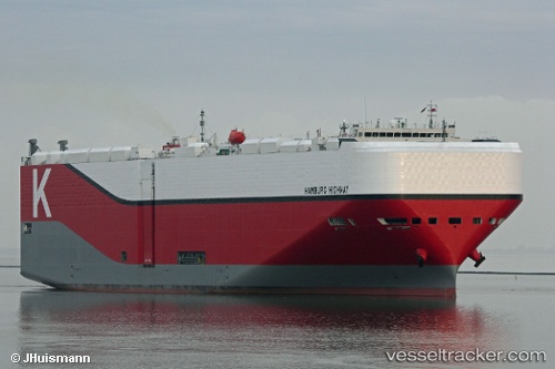
Hamburg Highway
Current StatusWhere is the vessel?
Hamburg Highway is currently in 64 nm S of Morro Redondo, based on AIS data received about 1h ago.
Latest AIS update:
Current position: 27.00539° N, 115.41713° W (64 nm S of Morro Redondo)
Average speed (last 7 days): Loading…
Average speed (last 30 days): Loading…
Vessel profile: Hamburg Highway is a Vehicles Carrier with dimensions 38m x 199m.
This page combines live AIS, route history, probable destination signals, nearby traffic, and port activity for practical vessel monitoring.
The current position of vessel Hamburg Highway is 27.00539 lat / -115.41713 lng. Updated: 2026-04-26 02:17:06 UTCNearest reference points:
- 38 nm W of Loreto
Details:
Live Vessel Hamburg Highway Analytics (details, animations, etc.)
Recent AIS points (UTC):
2026-04-25 22:18:57 UTC · 27.17679, -115.36949 · SOG 2.3 kn · COG 40°2026-04-25 23:42:38 UTC · 27.11887, -115.38332 · SOG 2.4 kn · COG 37°
2026-04-26 01:17:58 UTC · 27.04900, -115.40063 · SOG 2.7 kn · COG 42°
2026-04-26 02:17:06 UTC · 27.00539, -115.41713 · SOG 2.7 kn · COG 48°