 vesseltracker.com
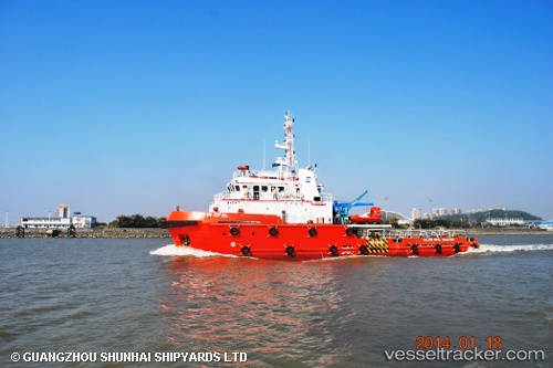
Mashhor 2
Current StatusWhere is the vessel?
Mashhor 2 is currently in 17 nm NE of MIRI, based on AIS data received about 1h ago.
Latest AIS update:
Current position: 4.61496° N, 114.16597° E (17 nm NE of MIRI)
Average speed (last 7 days): Loading…
Average speed (last 30 days): Loading…
Vessel profile: Mashhor 2 is a Tug with dimensions 10m x 41m.
This page combines live AIS, route history, probable destination signals, nearby traffic, and port activity for practical vessel monitoring.
The current position of vessel Mashhor 2 is 4.61496 lat / 114.16597 lng. Updated: 2026-05-13 20:03:08 UTCNearest reference points:
- 11 nm N of MIRI
- Near MIRI
- Near Kikeh
Details:
Live Vessel Mashhor 2 Analytics (details, animations, etc.)
Recent AIS points (UTC):
2026-05-13 16:06:56 UTC · 4.57275, 114.19806 · SOG 0 kn · COG 148°2026-05-13 17:33:56 UTC · 4.57275, 114.19804 · SOG 0 kn · COG 152°
2026-05-13 19:21:48 UTC · 4.57274, 114.19809 · SOG 0 kn · COG 155°
2026-05-13 20:03:08 UTC · 4.61496, 114.16597 · SOG 8.8 kn · COG 326°