 vesseltracker.com
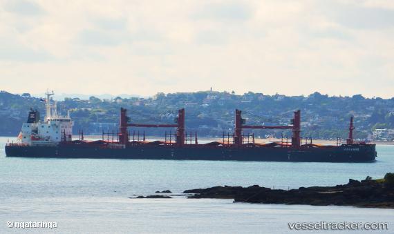
Hanyang
Current StatusWhere is the vessel?
Hanyang is currently in 26 nm S of Anglesea, based on AIS data received less than 1h ago.
Latest AIS update:
Current position: 38.83020° S, 144.32784° E (26 nm S of Anglesea)
Average speed (last 7 days): Loading…
Average speed (last 30 days): Loading…
Vessel profile: Hanyang is a Bulk Carrier with dimensions 30m x 180m.
This page combines live AIS, route history, probable destination signals, nearby traffic, and port activity for practical vessel monitoring.
The current position of vessel Hanyang is -38.83020 lat / 144.32784 lng. Updated: 2026-05-16 11:46:40 UTCNearest reference points:
- Near QUEENSCLIFF
- Near Geelong North
- Near Drysdale
Details:
Live Vessel Hanyang Analytics (details, animations, etc.)
Recent AIS points (UTC):
2026-05-16 08:10:00 UTC · -38.90235, 144.05840 · SOG 10.8 kn · COG 74°2026-05-16 09:37:10 UTC · -38.82342, 144.31595 · SOG 1.7 kn · COG 328°
2026-05-16 10:51:40 UTC · -38.82620, 144.31956 · SOG 0.3 kn · COG 305°
2026-05-16 11:46:40 UTC · -38.83020, 144.32784 · SOG 0.5 kn · COG 324°