 vesseltracker.com
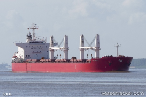
 YAYA GOOSE
Current Status
Where is the vessel?
YAYA GOOSE is currently in Near COEGA, based on AIS data received about 1h ago.
Latest AIS update:
Current position: 33.84314° S, 25.76311° E (Near COEGA)
Average speed (last 7 days): Loading…
Average speed (last 30 days): Loading…
Vessel profile: YAYA GOOSE is a Bulk Carrier with dimensions 200m x 32m.
This page combines live AIS, route history, probable destination signals, nearby traffic, and port activity for practical vessel monitoring.
The current position of vessel YAYA GOOSE is -33.84314 lat / 25.76311 lng. Updated: 2026-05-15 07:51:29 UTCNearest reference points:
- Near Deal Party
- 21 nm S of Mount Pleasant
Currently sailing under the flag of Marshall Islands ![]()
YAYA GOOSE built in 2016 year
Deadweight:
60425 tDetails:
Live Vessel YAYA GOOSE Analytics (details, animations, etc.)
Recent AIS points (UTC):
2026-05-15 04:18:25 UTC · -33.84253, 25.76279 · SOG 0.3 kn · COG 237°2026-05-15 05:36:31 UTC · -33.84328, 25.76312 · SOG 0.1 kn · COG 270°
2026-05-15 07:27:29 UTC · -33.84309, 25.76296 · SOG 0 kn · COG 261°
2026-05-15 07:51:29 UTC · -33.84314, 25.76311 · SOG 0.1 kn · COG 258°