 vesseltracker.com
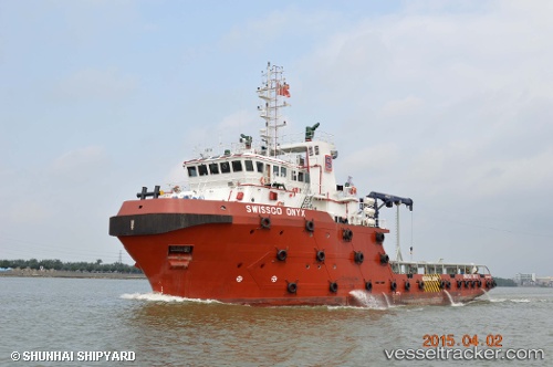
 RAWABI 35
Current Status
Where is the vessel?
RAWABI 35 is currently in Near DUBAI, based on AIS data received about 11d ago.
Latest AIS update:
Current position: 25.27325° N, 55.26025° E (Near DUBAI)
Average speed (last 7 days): Loading…
Average speed (last 30 days): Loading…
Vessel profile: RAWABI 35 is a Offshore Tug/Supply Ship with dimensions 61m x 16m.
This page combines live AIS, route history, probable destination signals, nearby traffic, and port activity for practical vessel monitoring.
The current position of vessel RAWABI 35 is 25.27325 lat / 55.26025 lng. Updated: 2026-05-02 07:44:49 UTCNearest reference points:
- Near DUBAI
- Near Free Port
- Near Dubai
Currently sailing under the flag of Tuvalu ![]()
RAWABI 35 built in 2015 year
Deadweight:
1800 tDetails:
Live Vessel RAWABI 35 Analytics (details, animations, etc.)
Recent AIS points (UTC):
2026-05-02 07:44:49 UTC · 25.27325, 55.26025 · SOG 0 kn · COG -1°2026-05-02 07:44:49 UTC · 25.27325, 55.26025 · SOG 0 kn · COG -1°
2026-05-02 07:44:49 UTC · 25.27325, 55.26025 · SOG 0 kn · COG -1°
2026-05-02 07:44:49 UTC · 25.27325, 55.26025 · SOG 0 kn · COG -1°