 vesseltracker.com
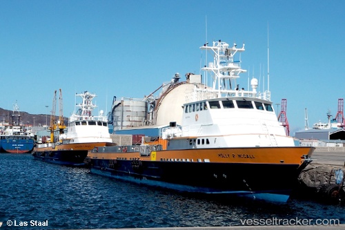
Molly R Mccall
Current StatusWhere is the vessel?
Molly R Mccall is currently in 26 nm E of Mirfa, based on AIS data received about 9d ago.
Latest AIS update:
Current position: 25.37728° N, 53.94627° E (26 nm E of Mirfa)
Average speed (last 7 days): Loading…
Average speed (last 30 days): Loading…
Vessel profile: Molly R Mccall is a Offshore Tug Supply Ship with dimensions 10m x 58m.
This page combines live AIS, route history, probable destination signals, nearby traffic, and port activity for practical vessel monitoring.
The current position of vessel Molly R Mccall is 25.37728 lat / 53.94627 lng. Updated: 2026-05-04 14:36:18 UTCNearest reference points:
- 11 nm SW of Fateh Terminal
- 16 nm NW of Jebel Ali
- Near KHALIFA
Details:
Live Vessel Molly R Mccall Analytics (details, animations, etc.)
Recent AIS points (UTC):
2026-05-04 14:36:18 UTC · 25.37728, 53.94627 · SOG 6.3 kn · COG 93°2026-05-04 14:36:18 UTC · 25.37728, 53.94627 · SOG 6.3 kn · COG 93°
2026-05-04 14:36:18 UTC · 25.37728, 53.94627 · SOG 6.3 kn · COG 93°
2026-05-04 14:36:18 UTC · 25.37728, 53.94627 · SOG 6.3 kn · COG 93°