 vesseltracker.com
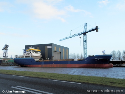
 Sefarina
Current Status
Where is the vessel?
Sefarina is currently in Near PAAL, based on AIS data received less than 1h ago.
Latest AIS update:
Current position: 51.37119° N, 4.13335° E (Near PAAL)
Average speed (last 7 days): Loading…
Average speed (last 30 days): Loading…
Vessel profile: Sefarina is a Lpg Tanker with dimensions 87m x 15m.
This page combines live AIS, route history, probable destination signals, nearby traffic, and port activity for practical vessel monitoring.
The current position of vessel Sefarina is 51.37119 lat / 4.13335 lng. Updated: 2026-05-13 21:53:40 UTCNearest reference points:
- Near Rilland
- Near Verrebroek
- Near Hansweert/Schore
Currently sailing under the flag of Netherlands ![]()
Details:
Live Vessel Sefarina Analytics (details, animations, etc.)
Recent AIS points (UTC):
2026-05-13 17:26:09 UTC · 51.35885, 2.91071 · SOG 10.7 kn · COG 84°2026-05-13 19:50:29 UTC · 51.42408, 3.61691 · SOG 11.3 kn · COG 89°
2026-05-13 19:55:38 UTC · 51.42447, 3.64605 · SOG 13.2 kn · COG 83°
2026-05-13 21:53:40 UTC · 51.37119, 4.13335 · SOG 14 kn · COG 74°