 vesseltracker.com
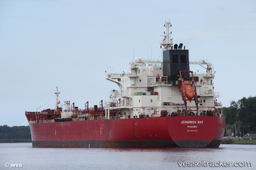
 Jennings Bay
Current Status
Where is the vessel?
Jennings Bay is currently in Near San Vicente, based on AIS data received less than 1h ago.
Latest AIS update:
Current position: 36.74595° S, 73.16473° W (Near San Vicente)
Average speed (last 7 days): Loading…
Average speed (last 30 days): Loading…
Vessel profile: Jennings Bay is a Chemical Oil Products Tanker with dimensions 183m x 32m.
This page combines live AIS, route history, probable destination signals, nearby traffic, and port activity for practical vessel monitoring.
The current position of vessel Jennings Bay is -36.74595 lat / -73.16473 lng. Updated: 2026-05-15 04:12:18 UTCNearest reference points:
- Near Arauco
- 28 nm W of Pichilemu
Currently sailing under the flag of Marshall Is ![]()
Details:
Live Vessel Jennings Bay Analytics (details, animations, etc.)
Recent AIS points (UTC):
2026-05-14 23:06:18 UTC · -36.74597, -73.16473 · SOG 0 kn · COG 304°2026-05-14 23:33:47 UTC · -36.74600, -73.16471 · SOG 0.1 kn · COG 305°
2026-05-15 03:57:47 UTC · -36.74598, -73.16474 · SOG 0 kn · COG 305°
2026-05-15 04:12:18 UTC · -36.74595, -73.16473 · SOG 0.1 kn · COG 305°