 vesseltracker.com
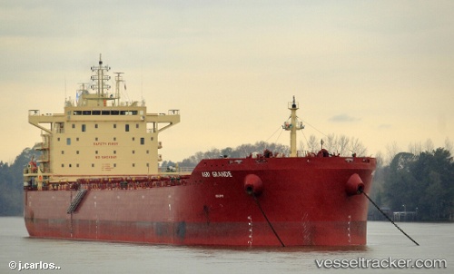
 PANAGIA S
Current Status
Where is the vessel?
PANAGIA S is currently in 153 nm NW of Burzaco, based on AIS data received less than 1h ago.
Latest AIS update:
Current position: 32.59513° S, 36.33378° W (153 nm NW of Burzaco)
Average speed (last 7 days): Loading…
Average speed (last 30 days): Loading…
Vessel profile: PANAGIA S is a Cargo with dimensions m x m.
This page combines live AIS, route history, probable destination signals, nearby traffic, and port activity for practical vessel monitoring.
The current position of vessel PANAGIA S is -32.59513 lat / -36.33378 lng. Updated: 2026-05-15 19:56:58 UTCCurrently sailing under the flag of Liberia ![]()
Details:
Live Vessel PANAGIA S Analytics (details, animations, etc.)
Recent AIS points (UTC):
2026-05-15 16:10:46 UTC · -32.54400, -35.63103 · SOG 9.7 kn · COG 268°2026-05-15 18:20:27 UTC · -32.57558, -36.03643 · SOG 9.4 kn · COG 266°
2026-05-15 19:48:44 UTC · -32.59431, -36.30850 · SOG 9.4 kn · COG 266°
2026-05-15 19:56:58 UTC · -32.59513, -36.33378 · SOG 8.8 kn · COG 267°