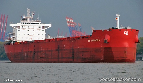
 STAR CAPOEIRA
Current Status
Where is the vessel?
STAR CAPOEIRA is currently in 116 nm SE of Maputo, based on AIS data received about 14h ago.
Latest AIS update:
Current position: 27.09667° S, 34.32833° E (116 nm SE of Maputo)
Average speed (last 7 days): Loading…
Average speed (last 30 days): Loading…
Vessel profile: STAR CAPOEIRA is a Cargo with dimensions m x m.
This page combines live AIS, route history, probable destination signals, nearby traffic, and port activity for practical vessel monitoring.
The current position of vessel STAR CAPOEIRA is -27.09667 lat / 34.32833 lng. Updated: 2026-05-23 11:38:32 UTCNearest reference points:
- 162 nm SE of Xai-Xai
- 42 nm E of Richards Bay
Currently sailing under the flag of Portugal ![]()
Details:
Live Vessel STAR CAPOEIRA Analytics (details, animations, etc.)
Recent AIS points (UTC):
2026-05-23 07:39:09 UTC · -26.46388, 34.99278 · SOG 13.3 kn · COG 219°2026-05-23 09:20:47 UTC · -26.73031, 34.69777 · SOG 12.8 kn · COG 221°
2026-05-23 10:14:09 UTC · -26.87107, 34.55538 · SOG 12.8 kn · COG 220°
2026-05-23 11:38:32 UTC · -27.09667, 34.32833 · SOG 12 kn · COG -1°