 vesseltracker.com
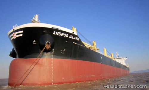
Andros Island
Current StatusWhere is the vessel?
Andros Island is currently in 118 nm E of Lü-hua Shan, based on AIS data received less than 1h ago.
Latest AIS update:
Current position: 31.17894° N, 124.87055° E (118 nm E of Lü-hua Shan)
Average speed (last 7 days): Loading…
Average speed (last 30 days): Loading…
Vessel profile: Andros Island is a Bulk Carrier with dimensions 32m x 199m.
This page combines live AIS, route history, probable destination signals, nearby traffic, and port activity for practical vessel monitoring.
The current position of vessel Andros Island is 31.17894 lat / 124.87055 lng. Updated: 2026-05-16 05:43:44 UTCNearest reference points:
- 116 nm E of Lü-hua Shan
- 97 nm E of Lü-hua Shan
- 151 nm E of Lü-hua Shan
Details:
Live Vessel Andros Island Analytics (details, animations, etc.)
Recent AIS points (UTC):
2026-05-16 01:51:05 UTC · 30.67920, 124.12342 · SOG 12.2 kn · COG 49°2026-05-16 04:21:15 UTC · 30.99941, 124.61177 · SOG 12.7 kn · COG 53°
2026-05-16 05:01:36 UTC · 31.08712, 124.74093 · SOG 12.5 kn · COG 44°
2026-05-16 05:43:44 UTC · 31.17894, 124.87055 · SOG 12.1 kn · COG 42°