 vesseltracker.com
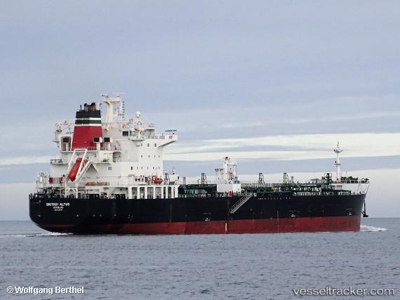
 SEA ALTUS
Current Status
Where is the vessel?
SEA ALTUS is currently in 26 nm N of Ile D’Ouessant, based on AIS data received about 1h ago.
Latest AIS update:
Current position: 49.08400° N, 5.30414° W (26 nm N of Ile D’Ouessant)
Average speed (last 7 days): Loading…
Average speed (last 30 days): Loading…
Vessel profile: SEA ALTUS is a Chemical/Oil Products Tanker with dimensions 183m x 32m.
This page combines live AIS, route history, probable destination signals, nearby traffic, and port activity for practical vessel monitoring.
The current position of vessel SEA ALTUS is 49.08400 lat / -5.30414 lng. Updated: 2026-05-13 19:37:50 UTCNearest reference points:
- 18 nm NE of Ile D’Ouessant
- 34 nm W of Verzy
- 28 nm N of Landunvez
Currently sailing under the flag of Marshall Islands ![]()
SEA ALTUS built in 2017 year
Deadweight:
39999 tDetails:
Live Vessel SEA ALTUS Analytics (details, animations, etc.)
Recent AIS points (UTC):
2026-05-13 16:27:29 UTC · 49.35430, -4.56135 · SOG 10.2 kn · COG 244°2026-05-13 18:09:51 UTC · 49.20521, -4.95716 · SOG 11 kn · COG 246°
2026-05-13 19:07:40 UTC · 49.12553, -5.17593 · SOG 10.9 kn · COG 249°
2026-05-13 19:37:50 UTC · 49.08400, -5.30414 · SOG 11.3 kn · COG 248°