 vesseltracker.com
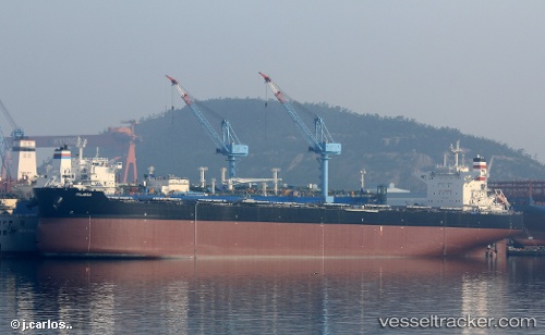
Jolanda
Current StatusWhere is the vessel?
Jolanda is currently in 12 nm NW of Karkinagri Ikarias, based on AIS data received less than 1h ago.
Latest AIS update:
Current position: 37.64834° N, 25.83914° E (12 nm NW of Karkinagri Ikarias)
Average speed (last 7 days): Loading…
Average speed (last 30 days): Loading…
Vessel profile: Jolanda is a Bulk Carrier with dimensions 45m x 292m.
This page combines live AIS, route history, probable destination signals, nearby traffic, and port activity for practical vessel monitoring.
The current position of vessel Jolanda is 37.64834 lat / 25.83914 lng. Updated: 2026-05-13 22:43:37 UTCNearest reference points:
- 13 nm NW of Karkinagri Ikarias
- Near MYKONOS OLD PORT
- Near FOURNI
Details:
Live Vessel Jolanda Analytics (details, animations, etc.)
Recent AIS points (UTC):
2026-05-13 19:16:27 UTC · 38.17790, 25.54189 · SOG 10 kn · COG 155°2026-05-13 20:15:58 UTC · 38.02914, 25.64135 · SOG 10.2 kn · COG 149°
2026-05-13 21:33:58 UTC · 37.83464, 25.78721 · SOG 10.3 kn · COG 154°
2026-05-13 22:43:37 UTC · 37.64834, 25.83914 · SOG 9.6 kn · COG 186°