 vesseltracker.com
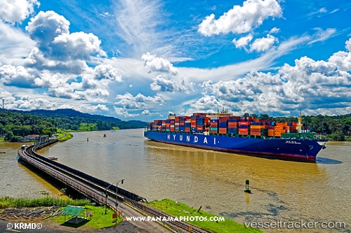
 HYUNDAI MARS
Current Status
Where is the vessel?
HYUNDAI MARS is currently in 21 nm NW of Thorntonbank, based on AIS data received about 1h ago.
Latest AIS update:
Current position: 51.81049° N, 2.44489° E (21 nm NW of Thorntonbank)
Average speed (last 7 days): Loading…
Average speed (last 30 days): Loading…
Vessel profile: HYUNDAI MARS is a Container Ship with dimensions 324m x 48m.
This page combines live AIS, route history, probable destination signals, nearby traffic, and port activity for practical vessel monitoring.
The current position of vessel HYUNDAI MARS is 51.81049 lat / 2.44489 lng. Updated: 2026-05-01 06:21:57 UTCNearest reference points:
- 21 nm S of Craven Arms
- 13 nm NW of Middelkerke
- Near Thorntonbank
Currently sailing under the flag of United Kingdom ![]()
HYUNDAI MARS built in 2016 year
Deadweight:
124092 tDetails:
Live Vessel HYUNDAI MARS Analytics (details, animations, etc.)
Recent AIS points (UTC):
2026-05-01 02:33:23 UTC · 52.46534, 3.31661 · SOG 13.1 kn · COG 212°2026-05-01 03:42:34 UTC · 52.25362, 3.07524 · SOG 13.6 kn · COG 214°
2026-05-01 04:10:23 UTC · 52.17348, 2.96847 · SOG 13.2 kn · COG 216°
2026-05-01 06:21:57 UTC · 51.81049, 2.44489 · SOG 13.4 kn · COG 220°