 vesseltracker.com
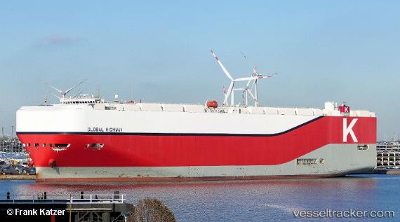
 Global Highway
Current Status
Where is the vessel?
Global Highway is currently in 136 nm NW of Bolinao, based on AIS data received about 1h ago.
Latest AIS update:
Current position: 17.68667° N, 117.95167° E (136 nm NW of Bolinao)
Average speed (last 7 days): Loading…
Average speed (last 30 days): Loading…
Vessel profile: Global Highway is a Vehicles Carrier with dimensions 199m x 199m.
This page combines live AIS, route history, probable destination signals, nearby traffic, and port activity for practical vessel monitoring.
The current position of vessel Global Highway is 17.68667 lat / 117.95167 lng. Updated: 2026-05-02 17:53:01 UTCNearest reference points:
- 138 nm NW of Bolinao
- 22 nm W of Salomague
- 34 nm W of Iba
Currently sailing under the flag of Panama ![]()
Details:
Live Vessel Global Highway Analytics (details, animations, etc.)
Recent AIS points (UTC):
2026-05-02 13:49:59 UTC · 18.55667, 118.87500 · SOG 17 kn · COG -1°2026-05-02 15:34:59 UTC · 18.19167, 118.47833 · SOG 18 kn · COG -1°
2026-05-02 16:29:01 UTC · 17.98667, 118.26667 · SOG 19 kn · COG -1°
2026-05-02 17:53:01 UTC · 17.68667, 117.95167 · SOG 17 kn · COG -1°