 vesseltracker.com
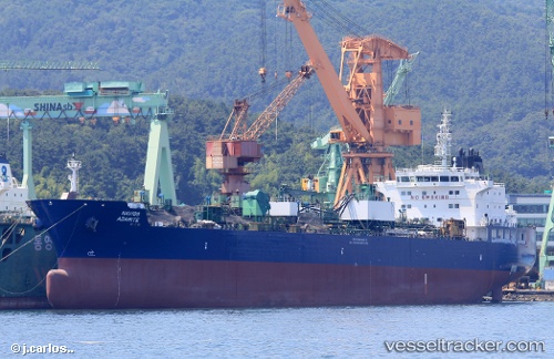
 Navig8 Adamite
Current Status
Where is the vessel?
Navig8 Adamite is currently in Near LUTCHER, based on AIS data received less than 1h ago.
Latest AIS update:
Current position: 30.03843° N, 90.68950° W (Near LUTCHER)
Average speed (last 7 days): Loading…
Average speed (last 30 days): Loading…
Vessel profile: Navig8 Adamite is a Chemical Oil Products Tanker with dimensions 184m x 27m.
This page combines live AIS, route history, probable destination signals, nearby traffic, and port activity for practical vessel monitoring.
The current position of vessel Navig8 Adamite is 30.03843 lat / -90.68950 lng. Updated: 2026-05-14 11:43:32 UTCNearest reference points:
- Near Port Of South Louisiana
- Near Good Hope
- Near Boutte
Currently sailing under the flag of Marshall Is ![]()
Details:
Live Vessel Navig8 Adamite Analytics (details, animations, etc.)
Recent AIS points (UTC):
2026-05-14 08:13:32 UTC · 30.03845, -90.68948 · SOG 0 kn · COG 232°2026-05-14 10:07:34 UTC · 30.03840, -90.68951 · SOG 0 kn · COG 232°
2026-05-14 11:19:34 UTC · 30.03840, -90.68950 · SOG 0 kn · COG 232°
2026-05-14 11:43:32 UTC · 30.03843, -90.68950 · SOG 0 kn · COG 234°