 vesseltracker.com
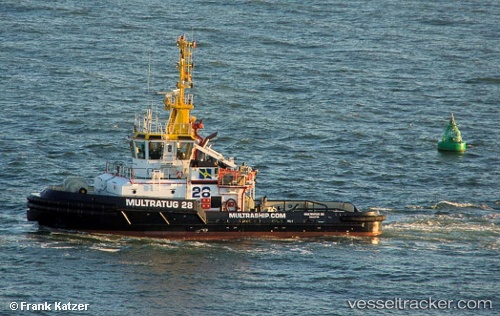
 Multratug 28
Current Status
Where is the vessel?
Multratug 28 is currently in Near Kallo, based on AIS data received less than 1h ago.
Latest AIS update:
Current position: 51.27853° N, 4.24710° E (Near Kallo)
Average speed (last 7 days): Loading…
Average speed (last 30 days): Loading…
Vessel profile: Multratug 28 is a [tug.fire_fighting_tug] with dimensions 32m x 12m.
This page combines live AIS, route history, probable destination signals, nearby traffic, and port activity for practical vessel monitoring.
The current position of vessel Multratug 28 is 51.27853 lat / 4.24710 lng. Updated: 2026-05-14 04:34:52 UTCNearest reference points:
- Near Doel
- Near Verrebroek
- Near Kallo
Currently sailing under the flag of Malta ![]()
Details:
Live Vessel Multratug 28 Analytics (details, animations, etc.)
Recent AIS points (UTC):
2026-05-14 01:23:59 UTC · 51.34539, 4.27166 · SOG 0.2 kn · COG 74°2026-05-14 01:31:45 UTC · 51.34574, 4.27301 · SOG 1.8 kn · COG 134°
2026-05-14 03:43:18 UTC · 51.34802, 4.27571 · SOG 0 kn · COG 288°
2026-05-14 04:34:52 UTC · 51.27853, 4.24710 · SOG 0.5 kn · COG 12°