 vesseltracker.com
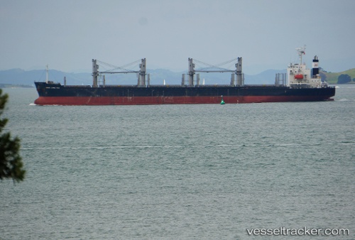
 AMIDALA
Current Status
Where is the vessel?
AMIDALA is currently in 49 nm E of ZHOUSHAN, based on AIS data received about 1h ago.
Latest AIS update:
Current position: 29.65452° N, 123.06230° E (49 nm E of ZHOUSHAN)
Average speed (last 7 days): Loading…
Average speed (last 30 days): Loading…
Vessel profile: AMIDALA is a Bulk Carrier with dimensions 30m x 180m.
This page combines live AIS, route history, probable destination signals, nearby traffic, and port activity for practical vessel monitoring.
The current position of vessel AMIDALA is 29.65452 lat / 123.06230 lng. Updated: 2026-05-14 00:04:16 UTCNearest reference points:
- 50 nm E of ZHOUSHAN
- 54 nm E of ZHOUSHAN
- 44 nm E of ZHOUSHAN
Currently sailing under the flag of Liberia ![]()
AMIDALA built in 2015 year
Deadweight:
34443 tDetails:
Live Vessel AMIDALA Analytics (details, animations, etc.)
Recent AIS points (UTC):
2026-05-13 19:58:17 UTC · 29.65353, 123.06042 · SOG 0.1 kn · COG 112°2026-05-13 21:22:16 UTC · 29.65404, 123.06095 · SOG 0.2 kn · COG 138°
2026-05-13 21:55:17 UTC · 29.65424, 123.06114 · SOG 0.1 kn · COG 143°
2026-05-14 00:04:16 UTC · 29.65452, 123.06230 · SOG 0.1 kn · COG 163°