 vesseltracker.com
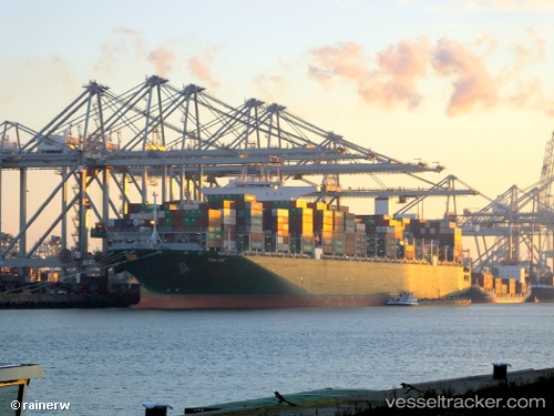
Talos
Current StatusWhere is the vessel?
Talos is currently in 342 nm E of Richards Bay, based on AIS data received less than 1h ago.
Latest AIS update:
Current position: 30.09717° S, 38.51384° E (342 nm E of Richards Bay)
Average speed (last 7 days): Loading…
Average speed (last 30 days): Loading…
Vessel profile: Talos is a Container Ship with dimensions 51m x 369m.
This page combines live AIS, route history, probable destination signals, nearby traffic, and port activity for practical vessel monitoring.
The current position of vessel Talos is -30.09717 lat / 38.51384 lng. Updated: 2026-05-17 10:10:57 UTCNearest reference points:
- Open sea, approx. 400 nm off the nearest listed port
- Open sea, approx. 401 nm off the nearest listed port
- Open sea, approx. 402 nm off the nearest listed port
Details:
Live Vessel Talos Analytics (details, animations, etc.)
Recent AIS points (UTC):
2026-05-17 07:23:17 UTC · -30.43134, 37.63202 · SOG 18 kn · COG 66°2026-05-17 07:43:15 UTC · -30.39012, 37.73779 · SOG 18.1 kn · COG 66°
2026-05-17 09:24:33 UTC · -30.19193, 38.27207 · SOG 17.8 kn · COG 66°
2026-05-17 10:10:57 UTC · -30.09717, 38.51384 · SOG 18 kn · COG 66°