 vesseltracker.com
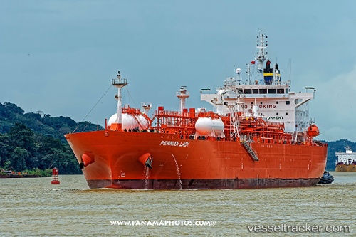
Permian Lady
Current StatusWhere is the vessel?
Permian Lady is currently in 284 nm N of Saint George, based on AIS data received less than 1h ago.
Latest AIS update:
Current position: 36.97794° N, 66.07101° W (284 nm N of Saint George)
Average speed (last 7 days): Loading…
Average speed (last 30 days): Loading…
Vessel profile: Permian Lady is a Lpg Tanker with dimensions 28m x 180m.
This page combines live AIS, route history, probable destination signals, nearby traffic, and port activity for practical vessel monitoring.
The current position of vessel Permian Lady is 36.97794 lat / -66.07101 lng. Updated: 2026-05-14 19:18:24 UTCNearest reference points:
- 273 nm SE of NANTUCKET
- 169 nm NE of Ben Slimane
Details:
Live Vessel Permian Lady Analytics (details, animations, etc.)
Recent AIS points (UTC):
2026-05-14 15:20:08 UTC · 37.05730, -67.31439 · SOG 13.9 kn · COG 95°2026-05-14 16:20:36 UTC · 37.05219, -67.00886 · SOG 15.8 kn · COG 96°
2026-05-14 17:20:32 UTC · 37.02213, -66.69196 · SOG 15.1 kn · COG 100°
2026-05-14 19:18:24 UTC · 36.97794, -66.07101 · SOG 15 kn · COG 97°