 vesseltracker.com
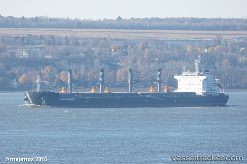
 Glory Harvest
Current Status
Where is the vessel?
Glory Harvest is currently in 387 nm SW of Baía dos Tigres, based on AIS data received about 2h ago.
Latest AIS update:
Current position: 21.33541° S, 7.10945° E (387 nm SW of Baía dos Tigres)
Average speed (last 7 days): Loading…
Average speed (last 30 days): Loading…
Vessel profile: Glory Harvest is a Bulk Carrier with dimensions 199m x 32m.
This page combines live AIS, route history, probable destination signals, nearby traffic, and port activity for practical vessel monitoring.
The current position of vessel Glory Harvest is -21.33541 lat / 7.10945 lng. Updated: 2026-03-28 19:37:25 UTCNearest reference points:
- Open sea, approx. 401 nm off the nearest listed port
- Open sea, approx. 403 nm off the nearest listed port
- Open sea, approx. 404 nm off the nearest listed port
Currently sailing under the flag of Marshall Is ![]()
Details:
Live Vessel Glory Harvest Analytics (details, animations, etc.)
Recent AIS points (UTC):
2026-03-28 17:48:15 UTC · -21.64398, 7.35799 · SOG 12.5 kn · COG 325°2026-03-28 17:48:15 UTC · -21.64398, 7.35799 · SOG 12.5 kn · COG 325°
2026-03-28 19:37:25 UTC · -21.33541, 7.10945 · SOG 12.6 kn · COG 323°
2026-03-28 19:37:25 UTC · -21.33541, 7.10945 · SOG 12.6 kn · COG 323°