 vesseltracker.com
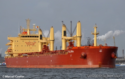
 ELISA
ELISA
Current Status
Where is the vessel?
ELISA is currently in 27 nm W of Sociedad Portuaria Regional Cartagena, based on AIS data received less than 1h ago.
Latest AIS update:
Current position: 10.52771° N, 75.96708° W (27 nm W of Sociedad Portuaria Regional Cartagena)
Average speed (last 7 days): Loading…
Average speed (last 30 days): Loading…
Vessel profile: ELISA is a Bulk Carrier with dimensions 32m x 189m.
This page combines live AIS, route history, probable destination signals, nearby traffic, and port activity for practical vessel monitoring.
The current position of vessel ELISA is 10.52771 lat / -75.96708 lng. Updated: 2026-05-14 21:50:32 UTCNearest reference points:
- Near Sociedad Portuaria Regional Cartagena
- Near Contecar
- 62 nm NE of Playón Chico
Currently sailing under the flag of Marshall Islands ![]()
ELISA built in 2016 year
Deadweight:
58623 tDetails:
Live Vessel ELISA Analytics (details, animations, etc.)
Recent AIS points (UTC):
2026-05-14 18:04:56 UTC · 10.56534, -76.00113 · SOG 0.8 kn · COG 104°2026-05-14 19:33:28 UTC · 10.55211, -75.98899 · SOG 0.7 kn · COG 85°
2026-05-14 19:45:30 UTC · 10.55045, -75.98695 · SOG 0.8 kn · COG 87°
2026-05-14 21:50:32 UTC · 10.52771, -75.96708 · SOG 1 kn · COG 95°