 vesseltracker.com
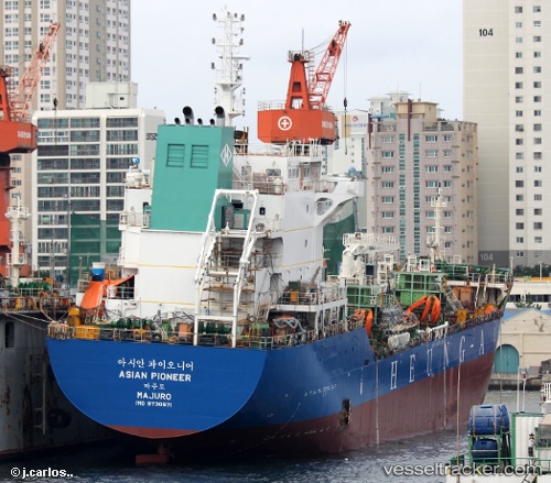
 ASIAN PIONEER
Current Status
Where is the vessel?
ASIAN PIONEER is currently in 29 nm E of Ranai, based on AIS data received less than 1h ago.
Latest AIS update:
Current position: 3.76333° N, 108.83833° E (29 nm E of Ranai)
Average speed (last 7 days): Loading…
Average speed (last 30 days): Loading…
Vessel profile: ASIAN PIONEER is a Chemical/Oil Products Tanker with dimensions 126m x 20m.
This page combines live AIS, route history, probable destination signals, nearby traffic, and port activity for practical vessel monitoring.
The current position of vessel ASIAN PIONEER is 3.76333 lat / 108.83833 lng. Updated: 2026-05-13 23:28:34 UTCNearest reference points:
- 34 nm SE of Ranai
- 45 nm E of Terempa
- 46 nm E of Kakap Natuna Terminal
Currently sailing under the flag of Korea (Republic of) ![]()
ASIAN PIONEER built in 2015 year
Deadweight:
12423 tDetails:
Live Vessel ASIAN PIONEER Analytics (details, animations, etc.)
Recent AIS points (UTC):
2026-05-13 20:01:34 UTC · 4.37833, 108.92333 · SOG 10 kn · COG -1°2026-05-13 22:01:32 UTC · 4.02000, 108.87167 · SOG 10 kn · COG -1°
2026-05-13 22:01:32 UTC · 4.02000, 108.87167 · SOG 10 kn · COG -1°
2026-05-13 23:28:34 UTC · 3.76333, 108.83833 · SOG 10 kn · COG -1°