 vesseltracker.com
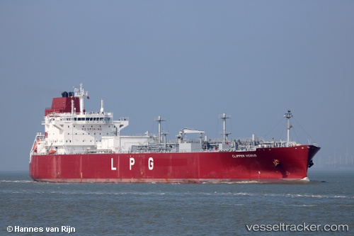
 Clipper Venus
Current Status
Where is the vessel?
Clipper Venus is currently in 15 nm SW of CHIPIONA, based on AIS data received less than 1h ago.
Latest AIS update:
Current position: 36.58815° N, 6.67306° W (15 nm SW of CHIPIONA)
Average speed (last 7 days): Loading…
Average speed (last 30 days): Loading…
Vessel profile: Clipper Venus is a Lpg Tanker with dimensions 199m x 199m.
This page combines live AIS, route history, probable destination signals, nearby traffic, and port activity for practical vessel monitoring.
The current position of vessel Clipper Venus is 36.58815 lat / -6.67306 lng. Updated: 2026-04-27 15:37:32 UTCNearest reference points:
- Near CHIPIONA
- Near Cadiz
- Near El Puerto de Santa María
Currently sailing under the flag of Norway ![]()
Details:
Live Vessel Clipper Venus Analytics (details, animations, etc.)
Recent AIS points (UTC):
2026-04-27 10:06:18 UTC · 36.58721, -6.67312 · SOG 0 kn · COG 92°2026-04-27 11:55:30 UTC · 36.58745, -6.67321 · SOG 0.8 kn · COG 114°
2026-04-27 13:40:31 UTC · 36.58743, -6.67317 · SOG 0 kn · COG 93°
2026-04-27 15:37:32 UTC · 36.58815, -6.67306 · SOG 0.4 kn · COG 127°