 vesseltracker.com
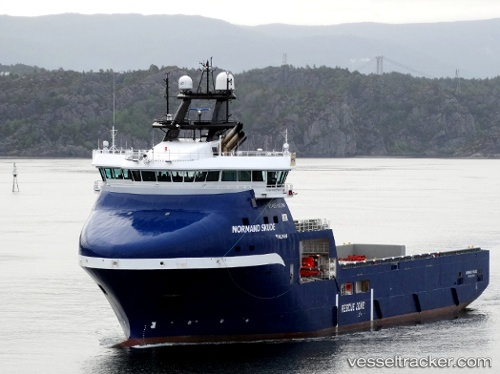
 Normand Skude
Current Status
Where is the vessel?
Normand Skude is currently in 25 nm SE of Snohvit, based on AIS data received less than 1h ago.
Latest AIS update:
Current position: 71.28173° N, 22.23704° E (25 nm SE of Snohvit)
Average speed (last 7 days): Loading…
Average speed (last 30 days): Loading…
Vessel profile: Normand Skude is a Offshore Tug Supply Ship with dimensions 87m x 20m.
This page combines live AIS, route history, probable destination signals, nearby traffic, and port activity for practical vessel monitoring.
The current position of vessel Normand Skude is 71.28173 lat / 22.23704 lng. Updated: 2026-05-15 16:07:48 UTCNearest reference points:
- Near SORVAR
- Near OKSFJORD
- 11 nm NW of ALTA
Currently sailing under the flag of Norway ![]()
Details:
Live Vessel Normand Skude Analytics (details, animations, etc.)
Recent AIS points (UTC):
2026-05-15 11:40:48 UTC · 71.28628, 22.26912 · SOG 0.2 kn · COG 146°2026-05-15 13:41:07 UTC · 71.28709, 22.26565 · SOG 0.1 kn · COG 191°
2026-05-15 13:59:57 UTC · 71.28716, 22.26463 · SOG 0.2 kn · COG 191°
2026-05-15 16:07:48 UTC · 71.28173, 22.23704 · SOG 0.7 kn · COG 106°